
Today, Prime Minister, Mark Carney, announced new, generational investments and initiatives to defend, connect, and transform Canada’s Arctic and Northern region.
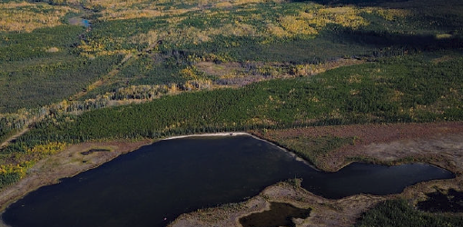
The Canadian Arctic is a region of significant geographic and strategic importance. It covers roughly 40% of Canada’s landmass and more than 70% of its coastline, encompassing the three territories of Yukon, the Northwest Territories, and Nunavut. Together, these territories span approximately 4 million km² and are home to more than 140,000 people. The region also supports a vibrant northern economy, with more than 11,000 businesses operating across the three territories.
Canada’s new government is:
Securing Canada’s Arctic and North
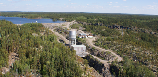
North American Aerospace Defense Command Northern Basing Infrastructure
As part of Canada’s plan to modernise its contributions to the North American Aerospace Defense Command (NORAD), announced in 2022, the Department of National Defence (DND) is investing in infrastructure upgrades at three Forward Operating Locations – Yellowknife, Inuvik, Iqaluit, and at Deployed Operating Base 5 Wing Goose Bay. Under the NORAD Northern Basing Infrastructure (NNBI) program, this $32 billion investment will enable the Canadian Armed Forces to defend the Arctic and protect our sovereignty. Infrastructure upgrades will include:
- Airfield improvements;
- New and/or repurposed hangars with aprons and taxiways;
- Ammunition compounds;
- Fuel facilities; and
- Accommodations, warehousing, multi-purpose facilities, information technology, and support equipment.
Northern Operational Support Hubs Program
The Northern Operational Support Hubs (NOSH) Program is a long-term investment to strengthen Canada’s military presence in the Arctic and the North. The program consists of a network of operational support sites designed to enable greater CAF presence and responsiveness across northern regions through the provision of infrastructure and logistical support, improve access, reduce logistical challenges, and support year-round operations. Today, two new NOSHs are being announced at Whitehorse, and Resolute. These stations will include airstrips, logistics facilities, pre-positioned equipment, and critical supplies to enable faster responses for search and rescue, natural disasters, and operations of all kinds.
Northern Operational Support Nodes (NOSN) are secondary support facilities that function as forward operating bases. Today, two new NOSN are being announced at Cambridge Bay and Rankin Inlet. These smaller sites will enable the CAF to project and sustain forces into more remote Arctic areas. NOSN provide much of the same support as hubs, but on a reduced scale. They will be equipped to accept and stage CAF operational and tactical aircraft.
Investing in Arctic airports
Rankin Inlet Airport Modernisation
Phase 1 upgrades to the Rankin Inlet Airport, including terminal improvements, are already underway, supported by $64 million from the National Trade Corridors Fund. Phase 2 upgrades, which will include re paving the end-of-life runway, will be funded through the Arctic Infrastructure Fund. Originally built by NORAD, the runway can accommodate CF 188 Hornet jets and large transport aircraft, though DND does not currently use it. Over time, the airport has evolved into a key logistics hub for Nunavut, supporting the territory’s supply chain. Upgrading the runway would enhance DND operational capability and strengthen the airport’s role as a hub for surrounding communities.
Inuvik Airport Runway and Access Road Work Upgrades
The Department of National Defence (DND) is already investing $230 million to extend and modernise the Inuvik Airport’s main runway. The federal government will provide an additional investment through the Arctic Infrastructure Fund, in partnership with the territory. This investment will fund upgrades to the runway and road access – reinforcing Canada's security, enabling reginal economic development, and connecting Northern and Indigenous communities.
Building Critical Infrastructure that Unlocks the Arctic’s and North’s Potential
The Major Projects Office (MPO) was created to accelerate the development of nation-building projects, driving Canada’s economic growth and strengthening our prosperity. Projects deemed to be of national significance are referred to the MPO, which will work with proponents, provinces, territories, Indigenous governments and organisations, and other stakeholders, to find the right way forward for these projects.
In September 2025, the Prime Minister referred the Arctic Economic and Security Corridor to the MPO as a transformative strategy. Since then, the MPO has been engaging with other federal departments, territorial, provincial, and Indigenous governments, Indigenous partners, and the private sector, to identify the kinds of projects needed in the North.
The Arctic Economic and Security Corridor transformative strategy has yielded four nation-building projects that are now being referred to the MPO to strengthen Arctic security, open new economic opportunities, and help connect communities. Together, these four projects represent around $10 billion in investment, and over 11,000 jobs during construction.
The Major Projects Office will bring together the people and processes needed to accelerate their development and operation by the early 2030’s, responsibly, sustainably, and while respecting the rights of Indigenous Peoples.
 Mackenzie Valley Highway
Proponent: Government of the Northwest Territories (GNWT)
Location: From Wrigley to Inuvik (in two distinct phases), Northwest Territories (exact routing still in development)
Project description
The Mackenzie Valley Highway will create a new all-season economic corridor up the Mackenzie Valley, reducing travel distance from Yellowknife to Inuvik by an estimated 1,200 km, and reducing travel time from 38 hours to roughly 23 hours. It will provide year-round connectivity to three currently isolated communities, and improve access to two additional communities by way of shorter construction periods for winter roads, increase resource access and stabilize the cost of living. The new road will create new opportunities for inter-territorial and inter-provincial trade, economic development, community resupply emergency response, and new tourism potential, with a scenic loop through the Yukon with the Dempster Highway. The new all-season road will support increased mineral and resource exploration activity in the Dehcho, Sahtu and Beaufort Delta regions and enhance Arctic security by connecting expanded NORAD Forward Operating Locations in Inuvik and Yellowknife.
 Grays Bay Road and Port (GBRP)
Proponent: West Kitikmeot Resources Corporation
Location: West Kitikmeot, Nunavut
Project description
The Grays Bay Road and Port (GBRP) is a ~230 km all-season gravel road from the Nunavut border to a deepwater port and airfield at Grays Bay. It will include a deepwater export terminal for minerals, and an airstrip, which will be located on the strategically important Arctic Ocean, and will have dual-use (civilian-military) potential. The Kitikmeot Inuit Association has been a proponent of the GBRP project since 2018, working to advance this initiative. The GBRP will enable new resource exploration and development including the potential for advancing mineral exploration and future mine development (such as copper, zinc, and gold).
Together with the Arctic Economic and Security Corridor, it will also provide a strategic transportation link, creating critical export links and helping stabilise transportation costs, create new opportunities for Indigenous and northern employment and business participation, and strengthen the Arctic and northern security.
 Arctic Economic and Security Corridor (AESC)
Proponents: Partnership between the Tłı̨chǫ Government, Yellowknives Dene First Nation, and the Government of the Northwest Territories
Location: Slave Geological Province/North Slave Region, Northwest Territories (exact location still in development)
Project description
The Arctic Economic and Security Corridor project is a planned ~400 km all season road, through the Slave Geological Province to the Nunavut border, where it will connect with the Grays Bay Road. Together with the Grays Bay Road and Port (GBRP) project, this project will establish a strategic transportation and critical export link. This road will also help stabilise transportation costs, create new opportunities for Indigenous and northern employment and business participation, and strengthen Arctic and northern security. Discussions are ongoing between the Tłı̨chǫ Government, Yellowknives Dene First Nation, and the Government of the Northwest Territories on routing for this project.
 Taltson Hydro Expansion
Proponent: Government of the Northwest Territories (GNWT)
Location: Great Slave Lake region, Northwest Territories
Project description
The Taltson Hydro Expansion Project is a transformative clean energy initiative that will double the Northwest Territories’ hydro capacity by building an additional 60-megawatt hydro facility. It will connect the North and South Slave Lake electrical grids for the first time, through a 320-kilometre transmission line, including a submarine cable section under Great Slave Lake. It also sets the stage for a future project to connect the Northwest Territories grid to the rest of Canada. This unified hydro grid will support clean power for communities, industrial development, and new resource projects across a mineral-rich region (such as copper, zinc, and gold), link 11 communities, and serve over 70% of the NWT’s population. The project will also reduce reliance on backup diesel systems, reducing greenhouse gas emissions by up to 240,000 tones (18% of the territory’s annual emissions), and enhance energy security in the region. Power from the facility to support the expanded NORAD Forward Operating Location in Yellowknife. The project is being advanced collaboratively by NWT Métis Nation (representing the Fort Resolution Métis Council, Hay River Métis Government Council and the Fort Smith Métis Council), Akaitcho Dene First Nations (representing Łutsel K’e Dene First Nation, Denınu Kų ́ ́ę́ First Nation, and Yellowknives Dene First Nation), and Salt River First Nation.
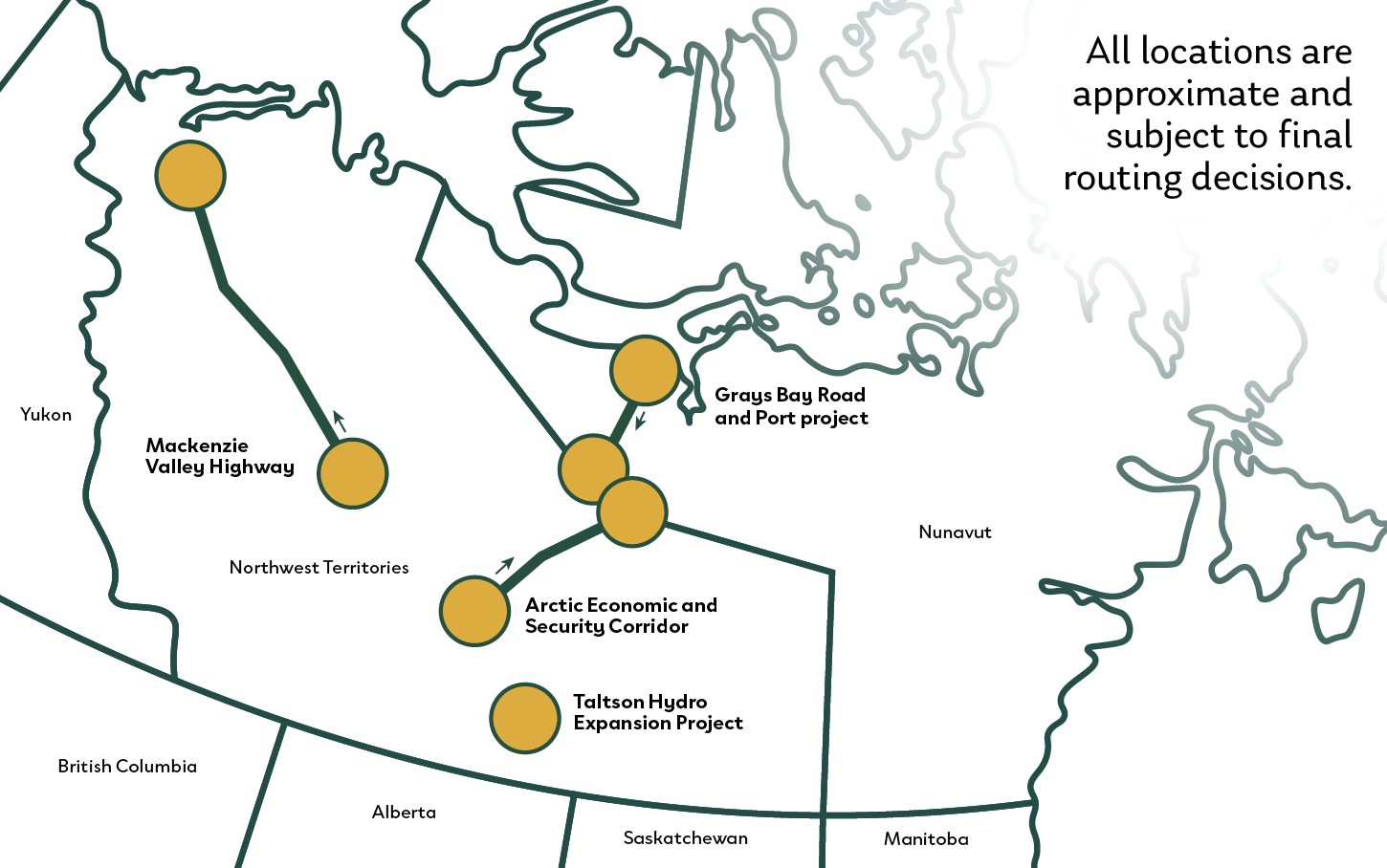
Figure: A partial map of Canada marking the locations of the four new Northern Resilience Projects:
- Mackenzie Valley Highway is in the Northwest Territories.
- Arctic Economic and Security Corridor is in the Northwest Territories.
- Taltson Hydro Expansion Project is in the Northwest Territories.
- Grays Bay Road and Port Project connect Nunavut and the Northwest Territories.
- All locations for these projects are approximate and subject to final routing decisions.